About Me
I’m a GIS and data professional with experience leading global geospatial projects, managing remote teams, and delivering high quality mapping and analysis products. I hold a Master’s Degree in both Data Science and GIS, with an undergraduate background in Environmental Studies. My work blends geospatial analysis, field data collection, data analytics and software supported workflows to turn complex spatial data into clear, actionable insights.
I’ve managed international ground imagery programs, contributed to OpenStreetMap road networks, led solar farm suitability studies for utilities, and supported UI/UX improvements for internal imagery viewing platforms.
I enjoy creating maps, stories, and tools that help people understand the world a little better and make better decisions about it.
ResumeExperience

GIS Project Manager
May 2022 – Apr 2025 · 3 yrs
As a GIS Project Manager, I oversaw a global operation that blended field data collection, geospatial analysis, and software development. I coordinated more than 50 international deployments, ensuring safe, efficient workflows while meeting demanding client expectations. I led imagery processing pipelines using JOSM, QGIS, OSM, and Mapillary, and kept data quality, transparency, and delivery timelines on track.
I partnered closely with clients and engineering teams, translating technical needs into clear development tasks. Managing a small software development team, I helped drive UI/UX improvements for our internal imagery platform, streamlining workflows, improving usability, and aligning features with analyst and client needs.
In addition to operational leadership, I oversaw hiring, budgeting, scheduling, and team performance, and contributed to business development through demos, web maps, and visual materials. I also supported various ad hoc GIS projects, including solar farm suitability assessments for utility clients, hard copy map production for local stakeholders, and large scale building footprint integrations into OSM in partnership with Esri.
Skills: Project Management · QGIS · Open Source Software · Team Leadership
GIS Technician II
Feb 2021 – May 2022 · 1 yr 4 mos
Worked on the QC team performing detailed quality control on geospatial edits in JOSM, validating road network accuracy, correcting topology issues, and ensuring updates met client specifications and OpenStreetMap standards.
Trained new team members in JOSM workflows, data editing best practices, and project-specific requirements, supporting onboarding until they were fully independent contributors.
Skills: Employee Training · JOSM · Quality Control
GIS Technician I
Dec 2019 – Feb 2021 · 1 yr 3 mos
Improved road and transportation infrastructure data in OpenStreetMap, contributing nearly 400,000 edits. Traveled internationally to collect street-level imagery to support global mapping efforts.
Supported client projects using JOSM, QGIS, and ArcGIS Pro to analyze datasets, refine map features, and deliver high-quality geospatial products.
Skills: QGIS · ArcGIS Pro · OSM · Cartography

GIS Technician
Jun 2019 – Dec 2019 · 7 mos
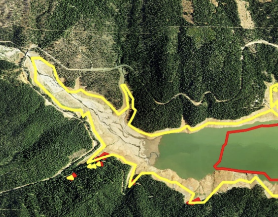
I used QGIS to analyze vegetation growth and identify where vegetation trimming was needed around PG&E power lines, to support wildfire prevention. I created heat maps to guide field crews and collaborated on building and troubleshooting the scripts and models that we used to download datasets and run automated analyses.
Skills: QGIS · Modelbuilder · Cartography

GIS Intern
Jul 2018 – Dec 2018 · 6 mos
Worked with the Anthropology department to bring existing paper records into a GIS database, standardizing location information and improving accessibility of archival data.
Skills: ArcGIS Pro · Geodatabase Creation · Data Inventory

GIS Analyst
May 2017 – Aug 2017 · 4 mos
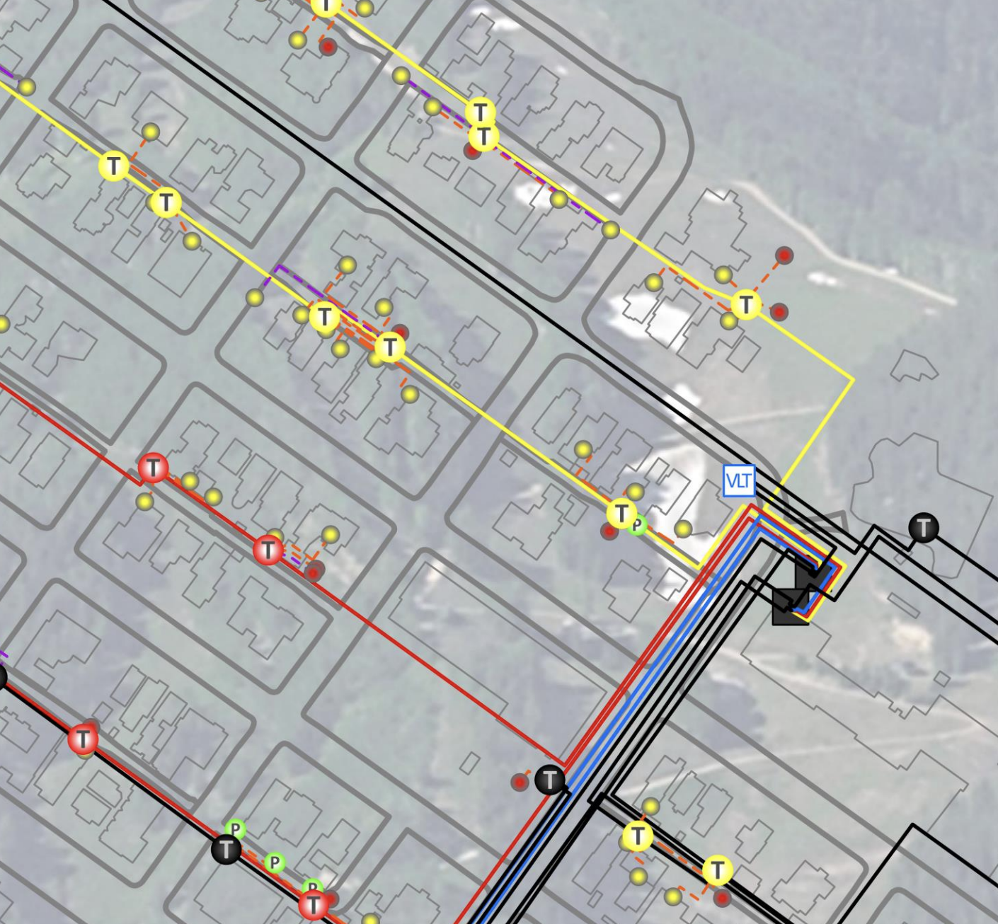
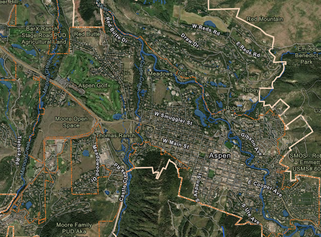
I supported the GIS Coordinator across a range of Esri based projects throughout the City of Aspen. I worked with multiple Esri tools to deliver maps, data, and analysis for various departments throughout the city. I built the GIS electric network for the Utilities Department, created web maps and contributed to the development of the city’s open data site, and regularly served as a public facing resource by responding to GIS requests, questions, and data needs.
Skills: ArcGIS Pro · Open Data · Electric Utilities
GIS Intern
May 2016 – May 2017 · 1 yr 1 mo
I worked with multiple departments across the City of Aspen to implement, maintain, and organize their geodatabases, supporting a wide range of municipal data needs. I created both desktop and web based maps for internal clients and public events, and processed LiDAR data and aerial imagery for the Aspen area, producing DEMs, intensity rasters, and other elevation derived products for use throughout the city.
Skills: ArcGIS Pro · Geodatabase Updates · LiDAR Processing · Aerial Imagery Analysis

Student Assistant – Esri User Conference
Jun 2016
I worked as a Student Assistant during the Esri User Conference, providing support and assistance to attendees and staff. Responsibilities included managing registration, facilitating sessions, and helping with technical issues that arose.

Wilderness Monitor Ranger
May 2015 – Aug 2015 · 4 mos
I backpacked throughout the San Juan National Forest to monitor campgrounds, dispersed sites, and high use backcountry areas, ensuring they met sustainability and Leave No Trace standards. I performed trail maintenance and light restoration work, documented site conditions for land management decisions, and regularly interacted with visitors to provide guidance, safety information, and education on responsible recreation practices.
Skills: Data Collection · Environmental Awareness · GPS
 2025
2025
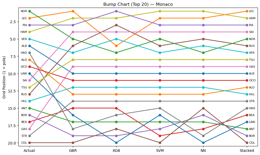
Predicting Lap Times in F1 Using Machine Learning
 2025
2025
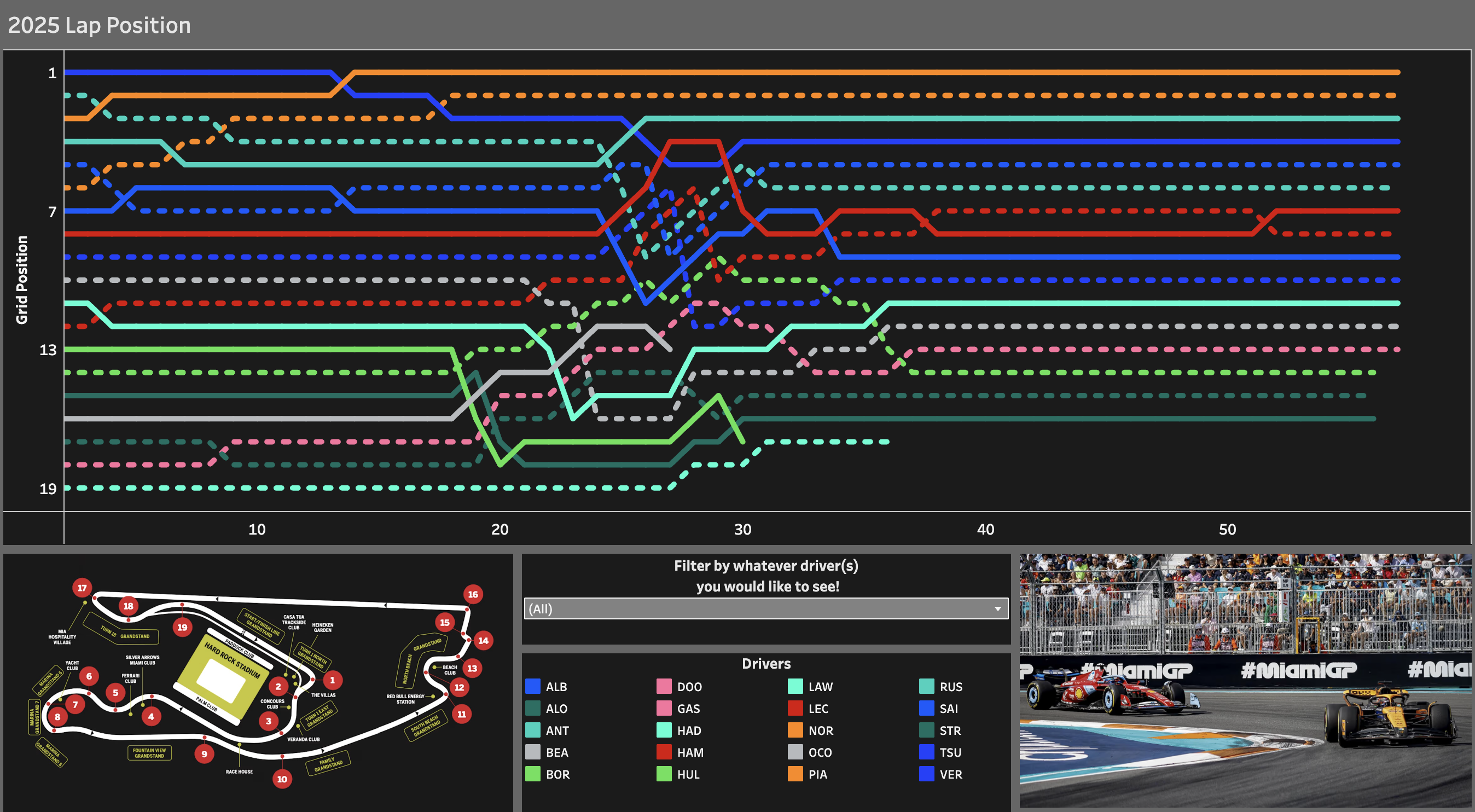
Miami F1 Dashboard
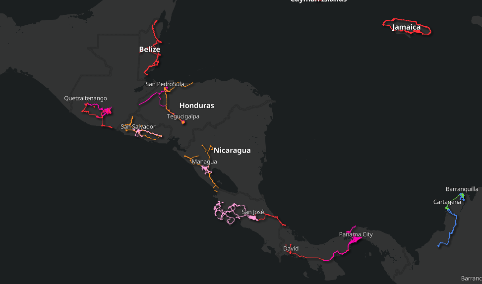
Kaart Drives Webmap
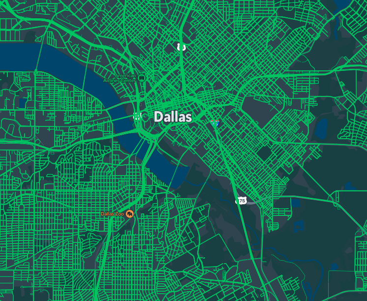
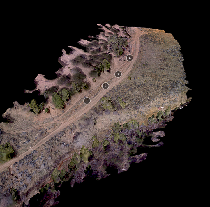
CPAL Imagery Collection Project
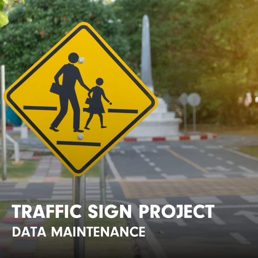
Traffic Sign Detection Project
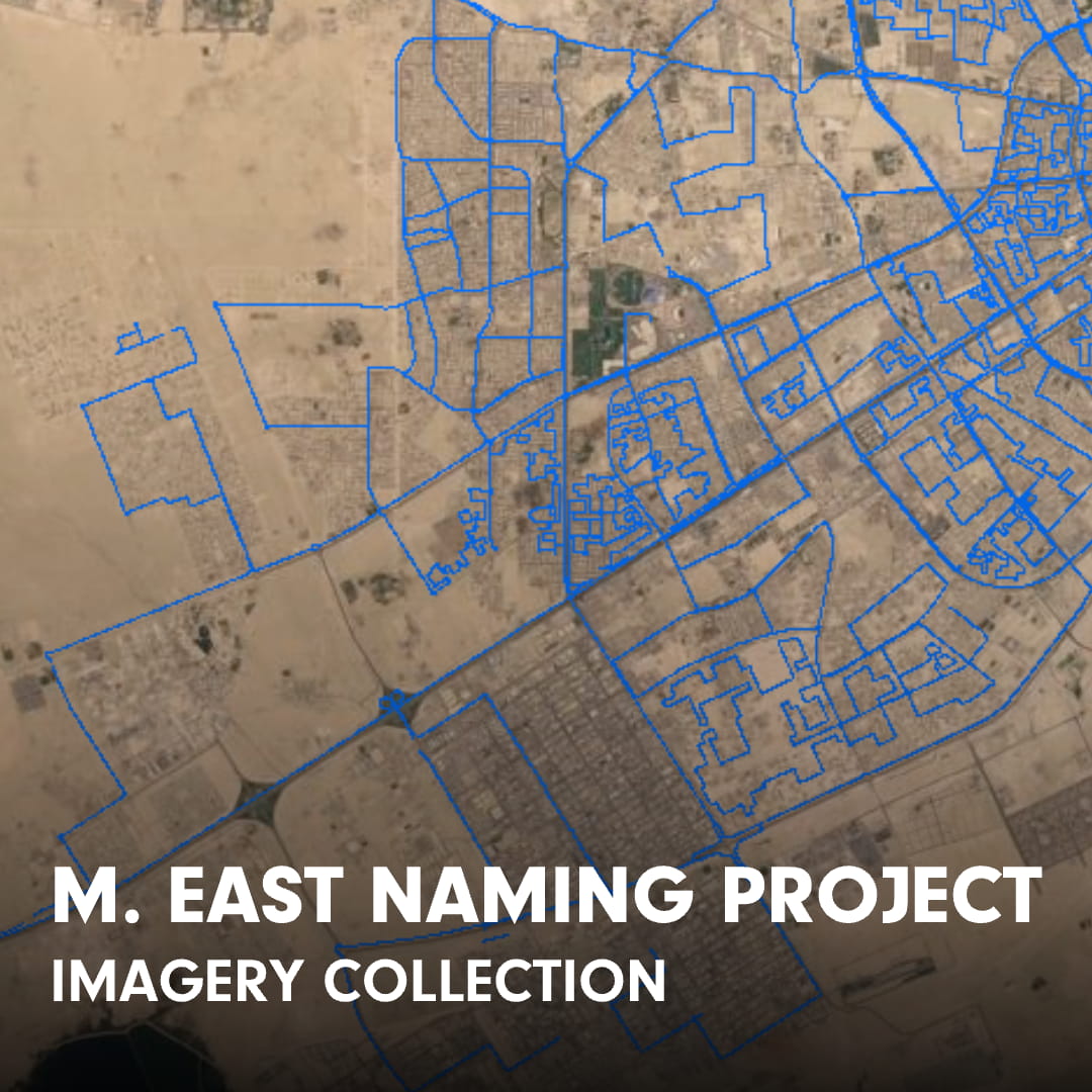
Qatar Naming Project
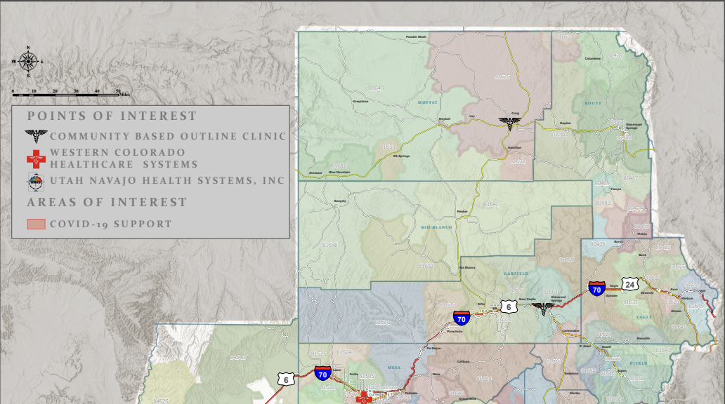
VA Western Slope Covid Map
Kaart OpenStreetMap Profile
City of Aspen Electric Utility Network Poster
City of Aspen Open Data Site
California Drought Analysis